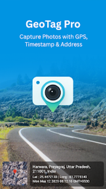
Capture Photos with GPS Precision Using GeoTag Pro
GeoTag Pro - GPS Map Camera is a specialized application designed for Android users, enabling them to capture photos enriched with GPS data, timestamps, and map overlays. This multimedia tool is particularly beneficial for professionals such as field agents, real estate agents, and delivery personnel, providing essential location-based information directly within the image. The app allows users to automatically tag photos with latitude and longitude coordinates, ensuring precise location tracking for every shot taken.
Key features include the ability to embed static map images with location pins, add customizable timestamps in local formats, and include full address information. Additionally, users can personalize their photos with custom watermark styles, which can enhance the professionalism of their documentation. With its focus on accurate metadata integration, GeoTag Pro is ideal for various applications such as travel photography, property documentation, and environmental monitoring, making it a valuable asset for anyone needing reliable photo tagging.